Current Real-Time Elevation - Carters Lake
Current Real-Time Elevation - Carters Re-regulation Pool
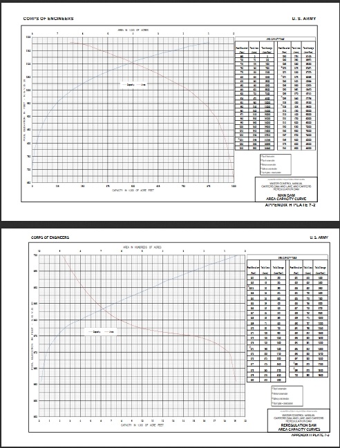
Area-Capacity Information
Text Reports - Avg, Max, Min Elevation as well generation (MWHr), inflows (cfs) and releases (cfs)
Annual (Year by year)
Monthly chronological
Monthly (Sorted Month/Year) with Rank
Ranked Inflows - Water Year, Month
Inflows By Month and Water Year with Rank By Year
High, Low, Mean Elevations By Water Year with Rank
Operation Percentiles - By Month
Power Production All Days of the week
ACF & ACT part of GA/AL/SC Weekly Generation (MWHR)
10 Project GA/AL/SC System Weekly Generation (MWHR)
Power Production Only Weeekdays (Monday - Friday)
ACF & ACT part of GA/AL/SC Weekly Generation (MWHR)
10 Project GA/AL/SC System Weekly Generation (MWHR)
Power Production Only Weekends (Sat and Sun)
ACF & ACT part of GA/AL/SC Weekly Generation (MWHR)
10 Project GA/AL/SC System Weekly Generation (MWHR)
Graphical Current Water Year Percentiles
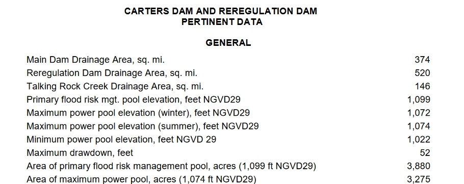
Carters Lake Pertinent Information